|
home | photosimulation & design viz | interchanges | sr120 mckinley avenue interchange |
|
SR120 McKinley Avenue Interchange
Photosimulations
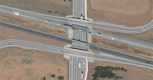
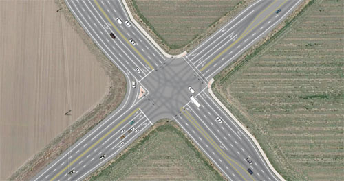
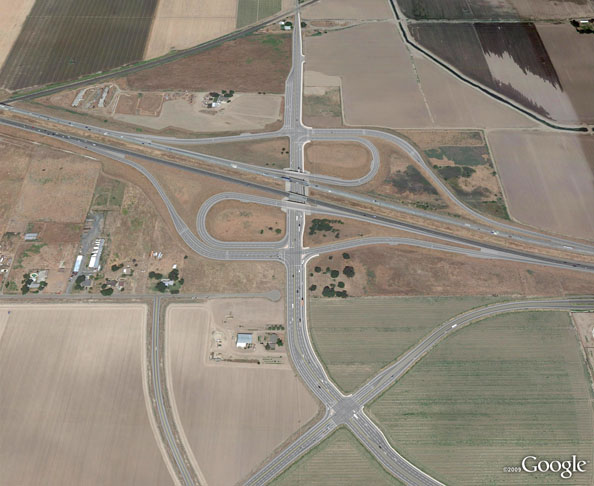
CalTrans, Manteca, California POITRA Visual was selected to provided design visualization services to the California Department of Transportation (CalTrans) and the City of Manteca to illustrate the proposed SR120 and McKinley Avenue Interchange. The design upgraded the existing overpass to a full interchange and widened McKinley Avenue. POITRA created several simulations for the project including this aerial view, eastbound and westbound ramp views and an overpass view. The aerial view was needed to communicate the overall configuration of the proposed Caltrans Type L-9 Modified interchange and other proposed intersecting roadways. The effects of the footprint for the new interchange on the City of Manteca's Master Plan would also be illustrated. |
Need an illustrator that can read your civil, structural or architectural plans? Artists at POITRA have actual design experience. Save yourself some time! |

|
| |||||||||||||||||||||||||||||||||||


|
The Engineer elected to provide their Google Earth Aerial plan photograph for the base of the photosimulation rather than the more typical oblique aerial. Aerial plans are often quicker to obtain. Aerial plan simulations have the advantage of giving equal coverage to all areas of a project due to the lack of perspective.
POITRA artists carefully plotted the proposed interchange onto the photograph from the design plans. Artists then painted the interchange overpass structure, retaining walls, ramp structures, and the pavement for ramps, Mckinley Avenue and additional proposed roads. Pavement markings, sidewalks, medians and islands were added to the roadways. Effected properties and existing trees were removed and all fill slopes indicated. All the work was performed using traditional digital painting techniques. The city master plan was overlaid onto the existing conditions photograph and then modified to show the plan after the full build out of the interchange and other roadways. The previous bridge and roadway design experience of the POITRA Visual principals always plays a significant role in accurately interpreting and representing the Engineer's design particularly on interchanges.
The final images were used in internal California Department of Transportation (CalTrans) and City of Manteca design sessions and for public outreach programs. |
Take a Closer Look! Highly developed skills of the Artists at POITRA make your concept a reality. (click to magnify) | ||||||||||||||||||